Disaster Preparedness With AI: Combating Climate Change with Human Ingenuity

Man-made climate change has increased the frequency and the severity of calamities such as droughts, floods, famines, and hurricanes. This has led to automating disaster preparedness and recovery actions using AI and ML solutions.
In the past 50 years, the number of recorded disasters has increased five times, and the resulting economic losses have increased seven times, according to the 2020 State of Climate Services Report by the World Meteorological Organization (WMO).
In 2018, around 108 million people required humanitarian aid because of natural disasters. The WMO estimates the number to go up by almost 50 percent by 2030 at a staggering cost of USD 20 billion.
Disaster Management committees are adopting technology such as Artificial Intelligence (AI) and Machine Learning (ML) to minimize the damage caused by such disasters by predicting their occurrences with great accuracy and assisting with the relief efforts.
Drone imagery, satellite data, and climate data can train AI and ML models as Disaster preparedness technology. They can study weather patterns to predict the intensity of rain or heat waves. They can also analyze sensor data and satellite imagery to forecast the location of future hurricanes.
This article will explore the applications and opportunities of AI and ML as Disaster Management Technology. We will also delve into the solutions offered by Gramener to mitigate the effects of natural disasters.

Role of Data and AI in Disaster Preparedness (Use Cases)
Disaster management personnel can use data to warn residents in high-risk areas. It can also help them assess the severity of a forthcoming calamity and prepare accordingly.
Insights from trained AI and ML models can help disaster management teams assign risk scores to public and private properties, enabling them to gauge infrastructure vulnerability in the event of a catastrophe.
Using Drone Imagery for Disaster Assessment
Portability, ease-of-use, and improved imaging capabilities have led to the widespread applications of drones or Unmanned Aerial Vehicles (UAV) technology. With capabilities like flight altitude and high-resolution cameras, they can help create detailed 2D images and 3D maps more precisely than satellite imagery.
In 2016, drones were used to gauge the structural damage in the Kathmandu valley after the Nepal earthquake. In 2017, drone imagery helped identify structural damage to houses built on alluvial deposits in the quake in Lesvos, Greece.
Predicting Hurricanes and Cyclones with Analytics
Predicting natural disasters poses a challenge due to the many variables involved — changing wind patterns, ocean currents, tides, etc. Predictive Analytics can be invaluable tools for natural disaster management. They can assimilate new data automatically, create better physical schemes and provide high-resolution results.
Modern disaster management teams have developed high-resolution prediction models for meteorological events like winter storms, hurricanes, and tropical cyclones. These models can deliver realistic simulations of seasonal variations, global distribution, and the structure of these events.
In 2016, the NASA Earth Science mission launched the Cyclone Global Navigation Satellite System (CYGNSS). The objective of CYGNSS is to use data to substantially improve the ability to forecast storm surges, intensity, and path of cyclones.
Data assimilation prediction models can incorporate updated observations into previous model forecasts to make new predictions. In addition to the severity and path of an impending cyclone, the model can also predict the spatial distributions of rainfall and surface wind 4–5 days before the storm makes landfall.
Predicting Intense Rainfall With Past Climate Data
Extreme precipitation events in the US Midwest account for more than half of all the flood disasters in the country. Stanford University researchers have trained a Machine Learning tool to identify the conditions that lead to such events.
Using AI for disaster planning and recovery, these researchers analyze the factors behind long-term changes in extreme weather events that could help predict them more accurately. To calculate the number of days with excessive rainfall, they used climate data from 1981 to 2019 that was publicly available.
They trained a Machine Learning algorithm developed to analyze grid data such as images to identify atmospheric patterns associated with severe rainfall. The algorithm outperformed the conventional statistical methods, identifying more than 90 percent of the days with an extreme downpour.
This AI technology for disaster response can predict severe precipitation in the future. It can also be applied to other disaster-prone regions.
Augmenting Satellite and Climate Data with AI
Atmospheric, Climate Science and Services (ACROSS) is an initiative of the Ministry of Earth Sciences (MoES), Govt. of India. MoES is tasked with predicting natural disasters such as tsunamis and earthquakes, ocean states, climate and weather changes such as monsoons, etc.
MoES uses Machine Learning algorithms and AI technology for disaster response to make complex mathematical calculations and analyze high-resolution spatial images for accurate forecasts. One of the objectives of ACROSS is to build an ecosystem that uses Artificial Intelligence and Machine Learning framework to deliver Big Data Analytics solutions.
Using Artificial Intelligence and Machine Learning algorithms, MoES intends to improve its weather forecasting capabilities vastly. It also wants to improve the skill set of its current models across time scales.
Using Sensor Data & AI To Develop Highly Accurate Building Footprints
A building footprint is the exterior walls outline of a building. It describes the exact location, shape, and size of the building’s foundation. It also gives the total area of the building.
Building footprint information is the preferred alternative to point representation when conducting risk assessments. This is because it provides a better description of spatial characteristics such as topology, proximity, orientation, relationship with other buildings, floor space ratio, distribution, form, location, etc.
By combining other attributes such as occupancy, use, number of floors, and building type with building footprint information, risk analysts can assess the vulnerability of a structure.
Manually generating building footprint maps of large areas is expensive and tedious. Fortunately, we can acquire accurate building footprint information using automated remote sensing or geospatial data solutions.
Drones, airplanes, and satellites equipped with specialized sensors capture high-resolution images of the earth’s surface. Trained AI and Machine Learning algorithms extract the relevant information from these geospatial images to create high-definition vector maps.
These digital maps can help develop highly accurate building footprint data layers to formulate efficient disaster management strategies.
Alerting People Residing in Disaster-Prone Areas
AI for disaster recovery can complement traditional alarm systems with coordinated and timely alerts when disaster strikes. It can reduce costs and response time by integrating with existing technological systems and expanding their reach.
AI technology for disaster response and telecommunication operators are partnering with each other in countries with disaster-prone areas to warn citizens about impending tsunamis and earthquakes in an easy and cost-effective way.
The Chinese company Xiaomi has integrated its MIUI operating system with an earthquake warning function that alerts its users about earthquakes before they impact.
The US Emergency Alert System depends on radio broadcasts and cell phones that are unreliable when trying to reach people inside buildings. One practical application of AI for disaster recovery would be to analyze real-time CCTV footage to identify emergencies and sound the alarm.
During the current pandemic, AI technology for disaster response can send alerts when Covid positive individuals enter an area or when the count of infected cases crosses a safety threshold, warranting improved preventive measures.
South Korea recently implemented a similar Disaster Management Technology to track infected patients. When implementing such measures, however, care must be taken not to violate the personal liberties of citizens.
Anticipate Flood-Related Disasters
Floods are one of the most devastating, naturally occurring disasters. Hundreds of millions of people worldwide are affected by floods each year, costing billions of dollars in damage. Unfortunately, the current forecasting and warning systems often fail to alert the authorities in time to prevent loss of life and property.
Thankfully, Google has now incorporated AI for disaster recovery into its Public Alerts to predict floods with higher accuracy. The AI models are trained using information such as elevation and terrain of a given region, river level readings, and historical events. Using this knowledge, these models generate maps and simulate innumerable scenarios that involve flooding.
The AI models have demonstrably predicted the frequency, location, and severity of river floods with greater precision than most traditional forecasting methods.
Twenty percent of all flood-related deaths in the world occur in India. Google has collaborated with the Ministry of Water Resources, Govt. of India, to pilot its AI flood-warning model in the Patna region.
The first alert was issued in September 2018.

Building an AI System for Disaster Preparedness, Response, and Recovery
Challenge
An August 2021 report published by the Intergovernmental Panel on Climate Change (IPCC) concluded that adverse weather conditions such as heatwaves, hurricanes, and droughts have worsened due to climate change.
In addition to causing irreparable damage to property and resources every year, natural disasters like those mentioned above wreak untold havoc on hundreds of millions of lives worldwide.
Approach
Fortunately, modern disaster management leverages AI for disaster recovery to predict such calamities with a high degree of accuracy, save lives in the line of fire, and mitigate damages.
One non-profit that offers relief and rehabilitation to vulnerable communities in disaster-prone areas is the Sustainable Environment and Ecological Development Society or SEEDS. Founded in 1994, SEEDS is the winner of the AI for Humanitarian action grant, a Microsoft initiative started in 2018.
Working closely with Microsoft and its ISV Gold Partner, Gramener, SEEDS has developed AI technology for disaster response to forecast disaster impact on at-risk populations.
Manually identifying houses that are most likely to be destroyed during a natural disaster is time-consuming. Sunny Lives, the AI model jointly developed by SEEDS, Microsoft, and Gramener, applies Machine Learning and Advanced Data Analytics to high-resolution satellite imagery to identify at-risk housing.
This enables SEEDS to concentrate its time and effort to help those with the highest risk of becoming homeless.
Solution
Sunny Lives has been trained to identify vulnerable buildings by the nature of their roofs. Roofs of houses can reveal the socio-economic conditions of the inhabitants. Roofs reinforced with cement and concrete are less likely to be damaged than thatched roofs.
Using high-resolution satellite imagery, data scientists from Gramener manually tagged more than 50,000 individual houses. They classified these roofs into seven different categories based on the materials used to build them.
Sunny Lives used this information as training data to identify roofs with an accuracy rate of nearly 90 percent.
Besides the condition of the roofs, other factors were also used to develop the AI model. Houses near a water body were more likely to be impacted by floods. Similarly, dwellings whose surrounding areas were covered by concrete were more likely to suffer from flooding since water would not seep into the soil below.
Other parameters such as vegetation and elevation profiles were also layered into the model to increase precision. It took four months to build Sunny Lives, and it was piloted during the 2020 Kerala and Tamil Nadu cyclones in India. In May 2021, it was deployed at scale during Cyclone Yaas.
Impact
Immediately after the forecast of Cyclone Yaas, the Gramener team acquired the high-resolution satellite imagery of the region in the path of the cyclone. Using this information, Sunny Lives was able to assign a risk score to every house in the area in just a few hours.
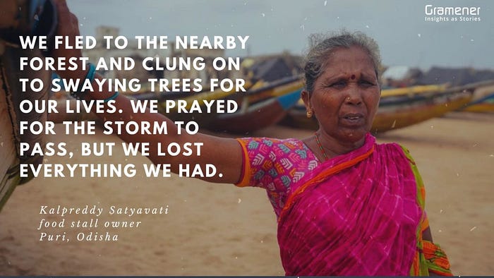
To vet the data generated by the model, Gramener used actual ground truth information and assisted in sampling techniques. Once the data was verified, SEEDS helped distribute written advisories to around 1,100 families in local dialects like Oriya and Telugu.
The advisory contained detailed instructions on securing their homes and where to relocate before the cyclone made landfall.
The success of Sunny Lives has led SEEDS to explore other disaster management applications of the AI for disaster recovery model. In addition to areas and communities vulnerable to cyclones, Sunny Lives can also help people affected by heatwaves, earthquakes, etc.
Conclusion
The World Meteorological Organization, the UN Climate Change Conference, and many other global bodies have all issued dire warnings of impending disasters brought about by climate change in the coming years and decades.
These natural calamities are expected to affect the human population worldwide with increasing frequency and severity. Fortunately, human ingenuity and enterprise have led to the development of technologies that can help us predict natural disasters with great accuracy and drastically reduce the loss of lives and property.
Artificial intelligence and Machine Learning algorithms are incredible armaments in our arsenal that we can weaponize to combat an unpredictable and invisible enemy immune to traditional forecasting methods.
Current AI and ML models have already proven successful in predicting catastrophes and saving lives. Future applications will undoubtedly be able to manage disasters with a greater degree of sophistication and may even forecast climate and weather upheaval with 100 percent accuracy.